
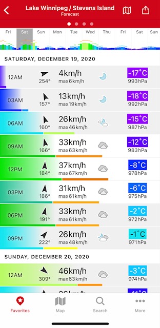
This one seems obvious, but the first thing to consider is the weather, what is the forecast, and what impact will it have on the ice. If you are like me as soon as the temperature drops below freezing, I get excited, and start preparing all my gear for first ice. There are many apps, and websites that will give you the forecast for the lake or river you’re looking to hit first ice. Here are my favourites, The Weather Network or their app available on IOS or Android.
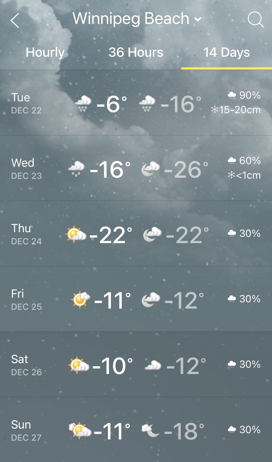
I’m looking at the long term forecast, and trying to predict, based on my experience, what it will have on water temps, and eventual ice formation. Another great tool is the ice growth chart.
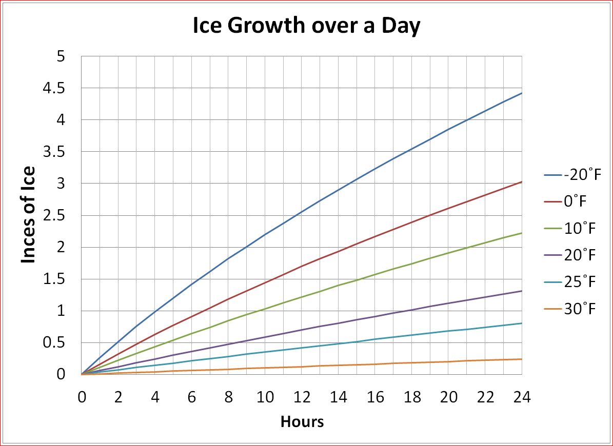
It allows you to calculate approximately how many inches of ice are being added each day. There are however many factors that can affect the growth rate, wind, current, snow load, etc. which brings me to my next tool.
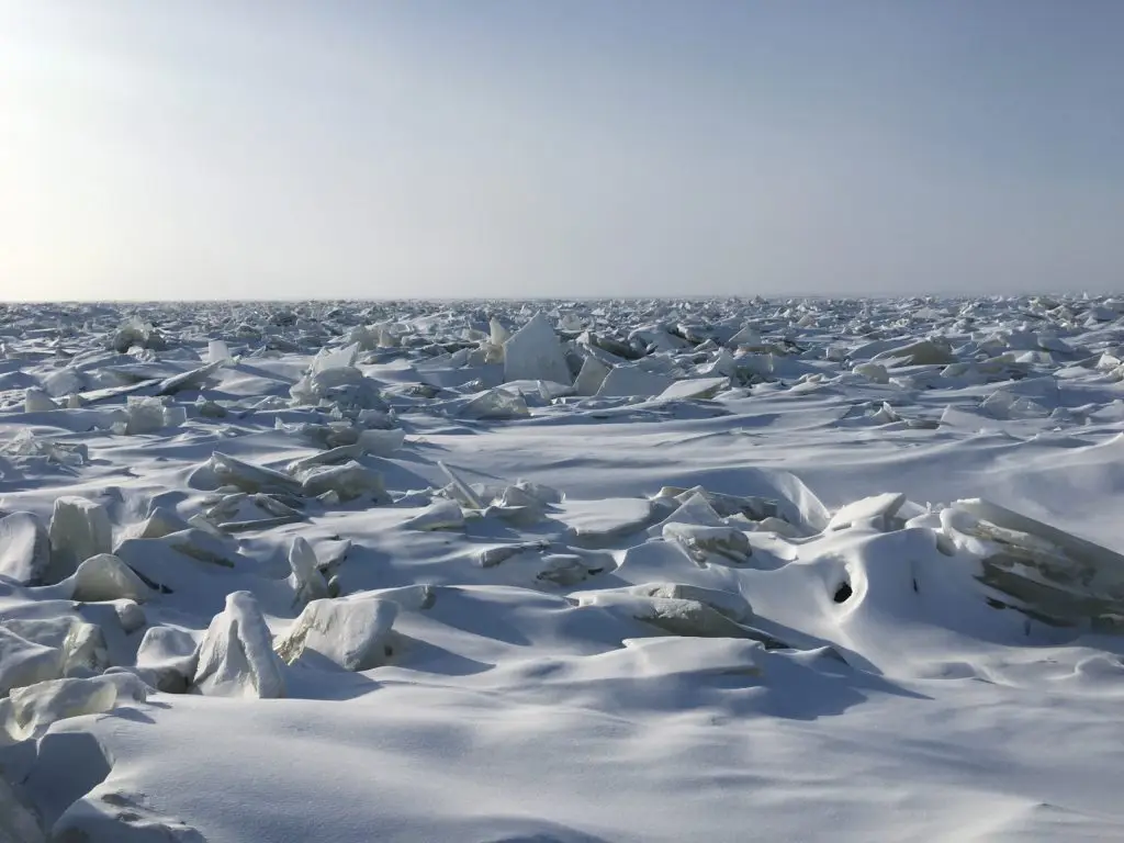
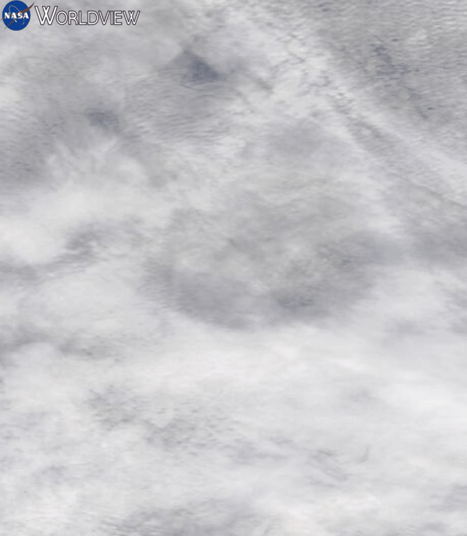 Once I see signs of ice along shore lines and bays, I start checking the satellite images daily. I’m not expecting to be taking the Snobear out any day now, but I am watching to see how the ice forms, and where trouble spots may lay (these early ice spots can remain trouble spots for the entire season). My main source is NASA’s EOSDIS Worldview website, which generally passes overhead once per day, as long as the sky is clear you can get a really good picture of the Lake. Once the lake is locked up on satellite , I’m doing the ice formation calculations in my head to figure out how thick the ice is, and I turn my attention to my next tool.
 The wind can be our best friend as it blows cold fall air over the lake dropping the water temperature, but in the middle of freeze up it is a nightmare. With the vast surface area of Lake Winnipeg if the wind gets going it puts a lot of pressure on the ice sheet, and until the lake is locked up with a minimum of twelve inches of ice on it, the wind will pop a ridge on one side of the lake and open up a crack on the other. We saw the results this past weekend with a group of anglers who with 10″ of ice underfoot found themselves blown out towards the middle of the lake as a massive cracked formed. They were lucky, a helicopter was able get to them, and they made it home safely. It easily could have been tragic had things gone differently.
I use the windfinder app, to look out for either high winds, or sustained winds in the forecast. It seems like every year there examples of individual getting stranded, or breaking through due to conditions that were entirely predictable by checking the satellite images, wind, and weather conditions.
 The most important advise I can give you is to check the conditions for yourself. Whether you are using a spud bar while traveling by foot on smaller bodies of water, or by drilling holes with your auger as you make your way out.
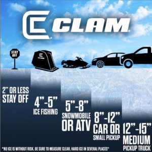
When I check conditions, I’m not just looking for the minimum thicknesses (see chart). I am comparing what I expect to see with what is actually under my feet, and if there are any surprises, I’m asking myself why before I venture any further.
Before you leave home, use these tools they get an overall view view of the area you plan to fish and what to expect when you get out there, check for yourself and Get Icebound.
For current conditions visit our Lake Winnipeg Ice Reports page